As the summer approached this year and I perused my calendar, I began thinking about where my travels have taken me. I made a decision many years ago to travel internationally while my health and stamina were up to the challenge of navigating time zone changes and language barriers; however, I was always aware that there are endless places to see in the United States, and you don't need a translator to visit them. With this in mind, I made a conscious decision to start seeing our national parks. I zeroed in on Acadia National Park on Maine's beautiful Atlantic coast to start with. It was a great move! Let me tell you about my experience there.
Bar Harbor
Our adventure began with driving into Bar Harbor, which is approximately in the center of the state on the Atlantic coast, in what is referred to as the Gulf of Maine. I got my maps out and was immediately aware that the park consists largely of Mount Desert Island, although there are many smaller islands in close proximity.
The history of Acadia dates back to 1604, when Samuel de Champlain came across the rugged terrain of the Maine coast and noted an island that had several mountains alongside each other. The tops were above the tree line. Below were forests consisting of pines, firs and birches. He named this Mount Desert Island.
Charles Eliot, a landscape architect, initially conceived the idea of establishing this area as as a national park. Woodrow Wilson conferred federal status to the park in 1916, and it became known as Acadia in 1929. Subsequently, John D. Rockefeller provided the funds to construct a network of gravel carriage trails, granite bridges and gate lodges that are still in existence today.
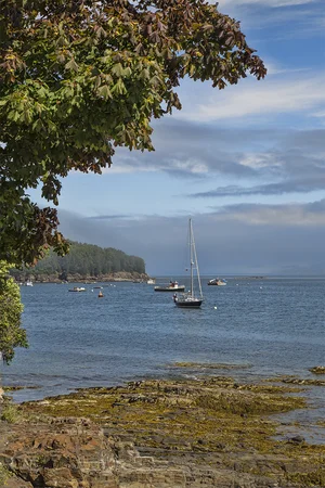
We hopped in the car and headed south of Bar Harbor along the Atlantic coast. I was immediately taken in by the rugged and rocky shoreline. As the waves crashed in, I could imagine how the topography of the coast was molded by millions of years of being subjected to beach erosion. There were numerous lobster buoys off shore. I had the definite feeling that I had seen some of these images before on photographic calendars.

Sand Beach
As we descended the coast, I constantly found myself pulling over to the side of the road, camera in hand, ready to shoot what I was seeing. I found that I was getting great photos by wandering through the nooks and crannies of Schooner Head, Great Head, Sand Beach, Thunder Hole and the Otter Cliff.
It was now time to start heading north to Cadillac Mountain. We ascended a long and winding road for 1,528 feet, the highest point within 25 miles of the shoreline on the North American continent. This vantage point provides the chance to see the nation's first sunrise in the fall and winter based on the direction of the sun during these seasons. At the summit we hiked on a pink granite ledge and took in great views of Bar Harbor and the Porcupine Islands across from Frenchman's Bay.

Cadillac Mountain, Porcupine Islands, Frenchman's Bay
The next day I knew our experience would be quite different. The skies were overcast and there was a light drizzle of rain. Not to worry! We got in the car and headed to Jordan Pond. We parked the car and hiked through the woods until we got to a clearing where we caught the first glimpse of what looked like a small lake. I found out that this is known by the geologic term, "oligotrophic tarn," which has to do with its freshwater characteristics including nutrient status and phosphorous concentration. This was formed during the Wisconsin Ice Sheet during the last glacial period and has a depth of up to 60 feet, the deepest in Maine.

Lisa at Bubble Rock
From there we hiked up the Bubble Rock trail where we came to the site of a 100-ton boulder perched on a precipice overlooking a giant ravine. It is thought that massive glaciers once carved out this area, pushing enormous rocks around such as the one we were seeing.
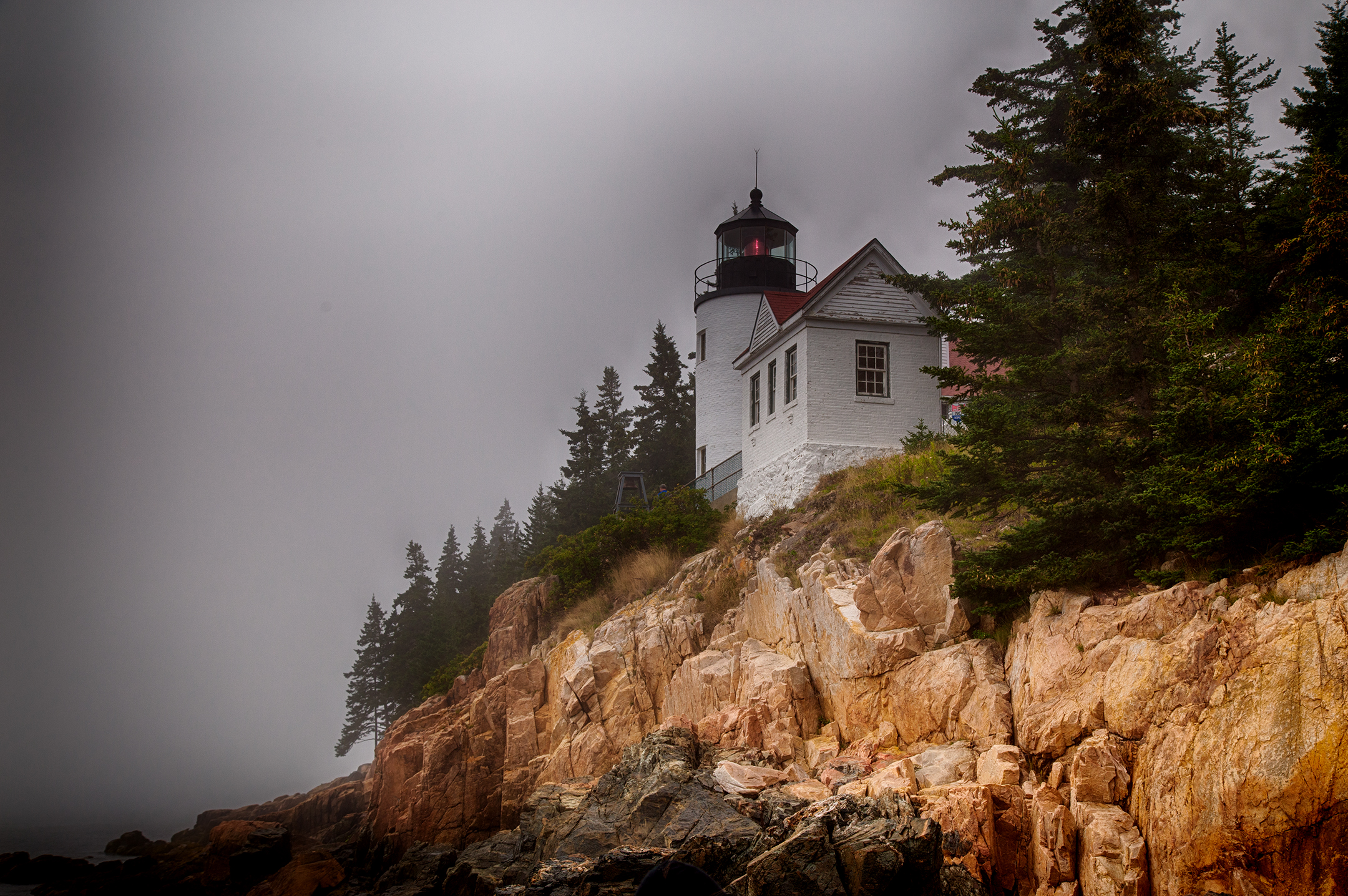
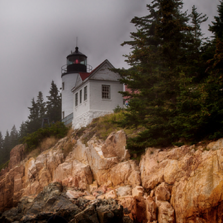
Our last stop for the day was a 45-minute trip down to the southern tip of Mount Desert Island known as the Bass Harbor Head Lighthouse. Apparently, many other tourists had the same idea, since we waited for a while for a parking spot to open up. Nevertheless, the wait was worth it.
The lighthouse dates back to its conception in 1855 when it was determined that there was a need for this type of structure. Since then, it has been added to the National Register of Historic Places. While protecting my camera, I made it down a series of granite boulders that provided me with a great view for shooting the lighthouse's harbor side.
As we departed Acadia the next day, it was obvious to me that we had just scratched the surface of seeing this gem on the Maine coastline of the Atlantic Ocean. Unlike any of my previous trips to Asia, I knew that the chances of returning to this park would be a possibility. At least, having a passport and arranging an international flight would not be required.